
Low-carbon hiking in Colorado
Nothing about long-distance hiking is normal, I think. Normal people don’t go away for weeks or months to live outside, walking 20 miles a day. But humans are nothing if not adaptable, and what seems at first to be profoundly abnormal (i.e., choosing to become a vagrant) can start to seem normal once you start doing it. And then this new normal creates its own expectations.
One of those expectations is that once you set out on a hike, you will be able to complete it. That if you don’t it is because of reasons of your own choosing, such as deciding you no longer like being a vagrant. What you don’t expect is that you have to get off trail because of disasters like wildfires. Or never get on it because the trail has been closed because of last year’s wildfires. Or the year before’s wildfires.
But that is normal now, and we are all getting used to it. When I got off the PCT at Elk Lake in 2021 I expected to be back in 2022, hiking the last 700 miles to Canada. But as the days counted down, the Lionshead closure was still in effect, as was the Canadian ban of Pacific Crest Trail (PCT) hikers. Hiking the PCT in 2022 would mean skipping a big chunk of Oregon.
So I made plans instead to do some long loops through the Sawtooths and the Wind Rivers. I would wait for the PCT to get back to normal and do some interesting hikes in beautiful country this summer.
We may be living in a new normal, but it’s not like the old normal was always great. Getting to a trailhead normally means burning up a lot of fossil fuels to get there. We’ve all implemented Leave No Trace on the trail, but getting TO the trail often requires high-impact activities like flying or driving hundreds of miles, emitting hundreds of pounds of CO2 in the process. A drive to Ketchum, ID and back would result in me pumping over 1,200 lbs of CO2 into the atmosphere. So much for LNT. This bothers me. Not enough to keep me from doing it, but it bothers me.
So when my wife and I were driving (yes) back from a hike in the Indian Peaks and the governor was on the radio talking about the new bus service to towns in western CO, I was ready to listen when she said “you know, instead of driving to Idaho, you should just take the bus to Crested Butte and walk home”.
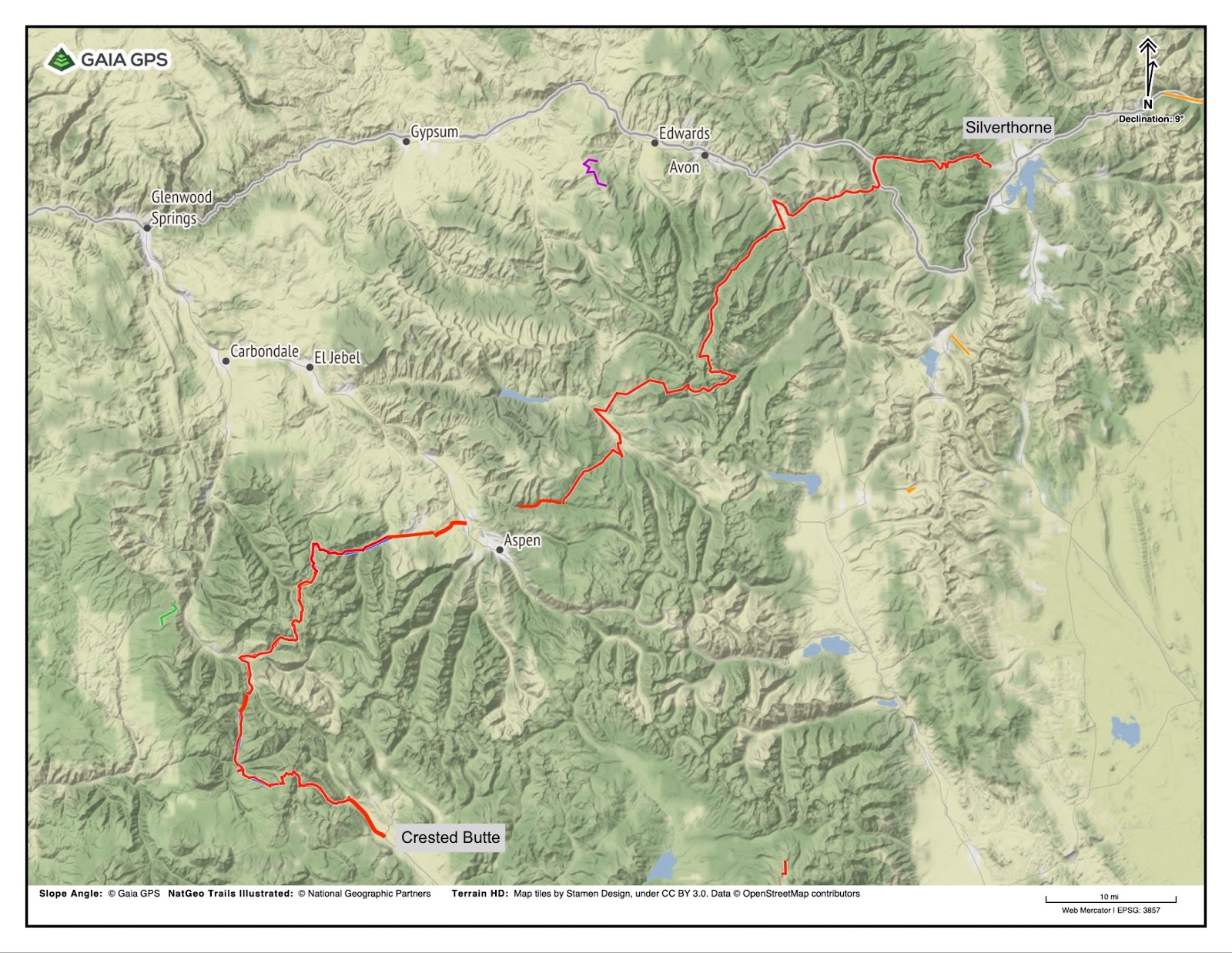
It was one of those ideas you know is right as soon as you hear it. I opened up Gaia GPS and in a few hours had a plausible route from Crested Butte (a ski town in western CO) to Nederland, a Boulder County mountain town with bus service. I could do a two-week traverse through the heart of the Colorado Rockies without getting in my car, relying solely on public transportation. Not a zero-carbon hike, but a low-carbon hike for sure.
Two days later I took the RTD (the regional agency operating public transit in the Denver-Aurora-Boulder Combined Statistical Area) to Denver’s Union Station, then got on the Bustang – headed to Crested Butte. There were maybe fifteen people on the bus, which was equipped with comfy seats and USB charging ports. We made three stops along the way, and just like that I was at my destination. I checked in at the hostel, walked downtown for dinner and a beer, and was on the road first thing in the morning.
Member Exclusive
A Premium or Unlimited Membership* is required to view the rest of this article.
* A Basic Membership is required to view Member Q&A events

Home › Forums › A Walk from Crested Butte